Welcome,
Guest! Login
Login
0 Items
$0.00
$0.00


Login to enter your own
review of this item.
 The Historical Archive is dedicated to creating a large, robust library of DVD and CD based products covering a wide range of significant and interesting historical events and cultural moments through film, photos, audios, maps and other documents. This growing collection of unique, special interest DVDs and CDs covers the full range of significant events that have shaped our culture, entertainment values and history.
Center total is the Seller's overall score, averaged from each active component:
|
Atomic Mall Feedback: Imported Feedback: Order Fulfillment Rate: |
100.0 99.8 100 | |
| Trophies Earned | ||
|
|

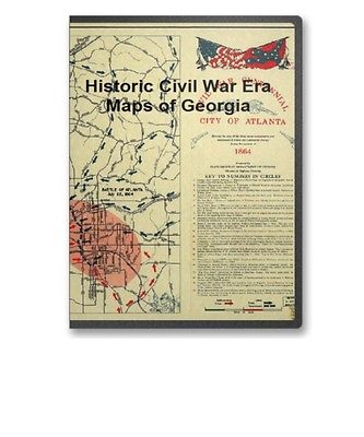
This CD contains 69 rare historic maps and descriptive pages representing fascinating details about Georgia and its vicinity during the Civil War in MrSid format. This format allows you to see the entire map on your computer screen or drill down to see the smallest details. The original maps are often quite large, as much as 36" long or larger and quite detailed. With the MrSID software, you can manipulate the map to print the entire map in great detail or zoom into a portion of the map in full detail for viewing or printing. You could even bring the images to a local print shop to have the maps reprinted in their full size. (MrSID software is included on the CD.)
To give you a sample of the detail you can expect in these maps, here is an example based on a panoramic map of Washington, DC.
The table below shows the and a small image of each map on this fascinating civil war history CD.
Northern Alabama and Georgia Compiled and engraved at the U.S. Coast Survey Office, from state maps, postoffice maps, local surveys, military reconnoissance and information furnished by the U.S. Engineers attached to the Military Division of the Miss. Drawn by A. Lindenkohl. Lindenkohl, A. CREATED/PUBLISHED S.l. , H. Lindenkohl & Chas. G. Krebs, lith., 1864? NOTES Scale 1:633,600. Signed in ink in upper margin: Llewellyn F. Haskell, Lt. Col., 7 U.S.C.I. July 15, 1864. DLC General map of northeastern Alabama and northwestern Georgia indicating cities and towns, roads and railroads, rivers, and some relief by hachures. Map overprinted in red to highlight state boundaries and railroads. Prison at Andersonville, Ga. United States Sanitary Commission. CREATED/PUBLISHED N.Y., Waters & son sc., 1864 NOTES Scale not given. From Sanitary Commission bulletin, v. 1, no. 21, Sept. 1, 1864. opp. p. 647. Plan of camp showing the prison, the "dead line," "Rebel camp," batteries, "Gen. Winder's headquarters," Capt. Wirtz's house, depot, cook house, dispensary, hospital, road, and drainage. Map of Atlanta and vicinity. July 1864 . Western and Atlantic Railroad Company. CREATED/PUBLISHED S.l., 1887 NOTES Scale ca. 1:165,000. From Century illustrated monthly magazine, v. 34, July 1887. p.457. Shows fortifications, roads, railroads, rivers, and towns. The battles of peach Tree Creek (July 20), Atlanta (July 22), and Ezra Church (July 28) are indicated. Map illustrating the siege of Atlanta, Ga., by the U.S. forces under command of Maj. Gen. W.T. Sherman, from the passage of Peach Tree Creek, July 19th 1864, to the commencement of the movement upon the enemy's lines of communication south of Atlanta, August 26, 1864 / reduced and engraved in the Engineer Bureau, War Dept., from an original prepared under the directions of Cap. O.M. Poe, Corps of Eng's and senr. engr. on Gen'l. Sherman's staff ; Edw. Molitor, lith. Poe, O. M. (Orlando Metcalfe), 1832-1895. CREATED/PUBLISHED Washington, D.C. : War Dept., 1865? (Engineer Bureau, War Dept.) NOTES Partial cadastral map showing selected buildings and householders' names beyond city limits. Covers area extending from Mt. Gilead Church in west to Decatur in east and from Buckhead in north to East Point in south. Relief shown by hachures and spot heights. Shows troop positions, Union and Confederate works, roads, railroads, vegetation, drainage, and names, dates, and sites of battles connected with Atlanta Campaign. Map illustrating the siege of Atlanta, Ga. by the U.S. forces under command of Maj. Gen. W. T. Sherman, from the passage of Peach Tree Creek, July 19th 1864, to the commencement of the movement upon the enemy's lines of communication south of Atlanta, August 26, 1864. Reduced and engraved in the Engineer Bureau, War Dept., from an original prepared under the directions of Cap. O. M. Poe, Corps of Eng's. and senr. engr. on Gen'l. Sherman's staff. Poe, O. M. (Orlando Metcalfe), 1832-1895. CREATED/PUBLISHED S.l., Edw. Molitor, lith., 1866 NOTES Scale ca. 1:47,520. From 39th Cong., 1st Sess. 1866 -Report of the Chief Engineer U.S.A. No. 2. In lower right margin: Bowen & Co., lith., Philada. Indicates entrenchments, relief by hachures, vegetation, drainage, roads, railroads, towns, and the names of a few residents in the environs of Atlanta. Map illustrating the military operations in front of Atlanta, Ga. From the passage of Peach Tree Creek, July 19th 1864, to the commencement of the movement upon the enemy's lines of communication, south of Atlanta, August 26th 1864 Compiled by authority of the Hon. the Secretary of War in the Office of the Chief of Engineers, U.S.A., 1875. United States. Army. Corps of Engineers. CREATED/PUBLISHED N.Y., Julius Bien & Co., photo lith., 1875 NOTES Scale ca. 1:32,000. Insets: A portion of the Confederate defenses of Atlanta. Scale ca. 1:1300. 16 x 14 cm. A portion of the U.S. defensive works erected after the capture of Atlanta. Scale 1:1200. 21 x 25 cm. Confederate and Union defenses shown in the insets are keyed to the map by the letters A to G and the numbers 7 to 12 respectively. Detailed map showing fortifications, headquarters, location and dates of battles, street outline of Atlanta, roads, railroads, vegetation, drainage, relief by hachures, towns, mills, churches, the location of rural houses, and the names of residents. Civil War Centennial, city of Atlanta : showing the area of the three major engagements and deployment of Union and Confederate forces during the summer of 1864 / prepared by State Highway Department of Georgia, Division of Highway Planning. Georgia. State Highway Dept. CREATED/PUBLISHED Atlanta : The Dept., 1964? NOTES Scale ca. 1:24,000. Includes index to points of interest and ill. (some col.). Map of Rome, Adairsville and vicinity Prepared for a presented with compliments of Western and Atlantic R. R. Co. Western and Atlantic Railroad Company CREATED/PUBLISHED Buffalo, N.Y., Matthews, Northrup & Co., Art-Printing Works, 1864 NOTES Scale ca. 1:350,000. Shows location of battles of Lay's or Tanner's Ferry, Adairsville, and Cassville, roads, railroads, towns, drainage, and relief by hachures. Map of Allatoona, New Hope Church and vicinity. Prepared for and presented with compliments of Western and Atlantic R. R. Co. Western and Atlantic Railroad Company. CREATED/PUBLISHED Buffalo, N.Y., Mathews, Northrup & Co., Art-Printing Works, 1864 NOTES Scale ca. 1:280,000. Shows location of battles of Allatoona, Allatoona Creek, Picketts Mill, and New Hope Church, roads, railroads, Confederate entrenchments, towns, drainage, and relief by hachures. Camp McDonald; a school of Instruction for the 4th Brigade Georgia Volunteers His excellency Governor Joseph E. Brown, Commander in Chief. Souvenir edition, 1917. McClellan, I. B. CREATED/PUBLISHED Atlanta, c1917. NOTES Scale 1:2400. Pictorial map showing parade grounds, tents, buildings, hospitals, streets, relief by hachures, and the names of principal officers. "The Georgia Military Institute was organized at Marietta, Georgia, in 1851, by Colonel A. V. Brumby; chartered at the session of the General Assembly in the winter of 1851-1852, and modeled after the U.S. Military Academy at West Point. During the war between the states Camp McDonald was established, including the Georgia Military Institute grounds and extending to Big Shanty (now called Kennsaw). Here recruits for the Confederate army were drilled by the cadets and new regiments organized. During the campaign from Dalton to the sea in 1864 the Georgia Military Institute cadets served with great credit. Camp McDonald was destroyed by Sherman and the school was never revived.-Joseph Tyrone Derry." Map of Chickamauga National Military Park. Ferger, Edward. CREATED/PUBLISHED S.l. , c1895. NOTES Scale not given. 98 sites are listed and keyed by number to the map. Chickamauga and Chattanooga National Military Park, Ga. (Chickamauga Battlefield). Geological Survey (U.S.) CREATED/PUBLISHED Washington, 1934 NOTES Scale 1:9600. "Advance sheet. Subject to correction." Title at top of sheet: Georgia. Chickamauga and Chattanooga National Military Park (Chickamauga Battlefield). Detailed topographic map indicating monuments and markers. 290 sites are listed and keyed by number to the map. Countour interval is 5 feet. Chickamauga and Chattanooga National Military Park, Georgia and Tennessee : principal roads and streets between Chattanooga and park areas. United States. National Park Service. CREATED/PUBLISHED Washington , Government Printing Office, 1957 NOTES Scale ca. 1:64,000. "NMP-CC-7004." "Reprint 1957." Illustrates descriptive leaflet by U.S. National Park Service entitled "Point Park, Lookout Mountain and Chattanooga Battlefields." Includes text and illustrations. Chickamauga and Chattanooga National Military Park. United States. National Park Service. CREATED/PUBLISHED Washington, U.S. Govt. Print. Off. 1968. NOTES Scale ca. 1:95,000. Folded title: Chickamauga and Chattanooga National Military Park, Georgia-Tennessee. Georgia, Chickamauga and Chattanooga National Military Park (Chickamauga Battlefield) / Department of the Interior, U.S. Geological Survey ; topography by Frank Larner and R. E. Amidon. Geological Survey (U.S.) CREATED/PUBLISHED Knoxville : Tennessee Valley Authority, 1975? NOTES Scale 1:9,600 or 1 in. = 800 ft. Alternate title in lower margin: Chickamauga and Chattanooga National Military Park, Ga. (Chickamauga Battlefield). Relief shown by contours and spot heights. Includes compilation diagr. and index of battle monuments and sites. Battle of--"Chickamauga"--Sep. 19th & 20th 1863 / under Col. W.E. Merrill. Merrill, W. E. (William Emery), 1837-1891. CREATED/PUBLISHED 1864 NOTES Relief shown by contours, spot heights, and gradient tints. Shows roads, rivers, and streams. Does not show troop positions. Note at upper left: Companion sheet to the other map marked No. 61--The other map represents the positions of the troops at the battle of Chicamauga sic , the roads, woods & fields, but does not represent the irregularities of the surface. This map represents the roads, rivers, and irregularities of the surface as developed by contour lines and heavy tints on the lower portions of the ground, the highest elevations being untinted. The two maps are from the same original and agree exactly in the roads and streams. This map was prepared as a guide to the draughtsman who might be employed to prepare the complete map of the Battle of Chicamauga sic . By carefully studying the contour lines and tints on this map an accurate map with hachures may be made of the ground. If then the locations of the troops are taken from the other map the battle map will be complete. W. E. M. i.e., William E. Merrill . Tour route, Chickamauga Battlefield, Chickamauga and Chattanooga National Military Park, Georgia and Tennessee. United States. National Park Service. OTHER TITLES Chickamauga battlefield. CREATED/PUBLISHED Washington , Government Printing Office, 1957. NOTES Scale ca. 1:55,000. Illustrates descriptive brochure entitled "Chickamauga Battlefield, Chickamauga and Chattanooga National Military Park, Georgia and Tennessee." Map indicates "Union defense line morning of Sept. 20." battlefield sites, park boundary, and tour route. Chickamauga Battlefield / National Park Service, U.S. Department of the Interior. United States. National Park Service. CREATED/PUBLISHED Washington : The Service, 1973 NOTES Scale not given. Folded title: Chickamauga Battlefield, Chickamauga and Chattanooga National Military Park, Georgia and Tennessee. Map of Chickamauga & Chattanooga National Park The Matthews-Northrup Co., Buffalo, N.Y. Nashville, Chattanooga, and St. Louis Railway. CREATED/PUBLISHED Nashville, Nashville, Chattanooga & St. Louis Ry., 1895 NOTES Scale ca. 1:57,000. Copyright, 1895, by Nashville, Chattanooga & St. Louis Ry. Map of Chickamauga and Chattanooga National Military Park Drawn by B. B. Ramey. Copyrighted 1895, by W. E. Birchmore. Engraved by Buff alo Elec. & Eng. Co. Ramey, B. B. CREATED/PUBLISHED S.l. , c1895. NOTES Scale 1:12,000. Map indicates roads, drainage, houses, and names of residents. "Key to monuments, locations, and markers" depicted on map reproduced on p. 40 of text. Aero view of Chickamauga and Chattanooga National Military Park (looking east). Painted by Rudolph J. Shutting. Shutting, Rudolph J. CREATED/PUBLISHED Chattanooga, 1913. Knoxville, Tenn., Tennessee Valley Authority, 1974? NOTES Perspective map not drawn to scale. Photocopy; blue line print. Oriented with north to the left. Bird's-eye-view. Indexed for points of interest. Battle field of Chickamauga, Georgia / surveyed by command of Major Genl. G. H. Thomas, Commanding Department of the Cumberland, by Capt. C. H. Boyd, Sub-Asst. U.S. Coast Survey, April and May 1864 ; assisted in levelling by Lieut. Kuntze & Sergeant Wilson. Boyd, Charles H. CREATED/PUBLISHED Knoxville : Tennessee Valley Authority, 1975? NOTES Scale ca. 1:31,000 (not "1:20,000"). Battle-field of Chickamauga, surveyed by command of Maj. Gen. Thomas, comdg. Dept. of the Cumberland by Capt. C. H. Boyd, U.S. Coast Survey. April & May 1864. Autogr. & printed under direction of Col. Wm. E. Merrill, Chief Engr., D.C., Chattanooga, October, 1864. Boyd, Charles H. CREATED/PUBLISHED Chattanooga, 1864 NOTES Scale 1:20,000. Shows roads, fords, drainage, vegetation, houses, names of residents, fences, and relief by contour lines. Some fortifications are given but troop positions and movements during the Battle of Chickamauga are not indicated. Battle-field of Chickamauga. Sept 18-20, 1863 . Wells, Jacob. CREATED/PUBLISHED S.l. , 1887. NOTES Scale ca. 1:84,000. From Century illustrated monthly magazine, v. 33, April 1887. p. 954. Indicates by symbols the "positions, evening of Sept. 18, 1863," "direction of lines of battle, Sept. 19th," "first lines of battle, Sept. 20th," "last lines of battle, Sept. 20th," "positions of Union troops after the battle," and positions of the cavalry. Map also includes roads, rivers, fords, bridges, relief by hachures, and houses. Chickamauga battlefield. Accompanies The battle of Chickamauga. Historical map and guide book. By J. C. McElroy of the Ohio Commission, late Captain 18t
