Welcome,
Guest! Login
Login
0 Items
$0.00
$0.00


Login to enter your own
review of this item.
 The Historical Archive is dedicated to creating a large, robust library of DVD and CD based products covering a wide range of significant and interesting historical events and cultural moments through film, photos, audios, maps and other documents. This growing collection of unique, special interest DVDs and CDs covers the full range of significant events that have shaped our culture, entertainment values and history.
Center total is the Seller's overall score, averaged from each active component:
|
Atomic Mall Feedback: Imported Feedback: Order Fulfillment Rate: |
100.0 99.8 100 | |
| Trophies Earned | ||
|
|

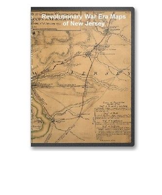
This CD contains 54 rare antique maps and descriptive pages representing fascinating details about New Jersey and its vicinity during the Revolutionary War in MrSid format. This format allows you to see the entire map on your computer screen or drill down to see the smallest details. The original maps are often quite large, as much as 36" long or larger and quite detailed. With the MrSID software, you can manipulate the map to print the entire map in great detail or zoom into a portion of the map in full detail for viewing or printing. You could even bring the images to a local print shop to have the maps reprinted in their full size. (MrSID software is included on the CD.)
To give you a sample of the detail you can expect in these maps, here is an example based on a panoramic map of Washington, DC.
The table below shows the and a small image of each map on this incredible history CD.
Map of the coast of New Jersey from Barnegat Inlet to Cape May. CREATED/PUBLISHED 177-? NOTES Scale ca. 1:32,000. Manuscript, pen-and-ink. Oriented with north to the right. Relief shown by shading. Soundings shown in fathoms. Shows the coast and the Mullica River inland to the site of the "Batsto forge." Indexed for points of interest. Sketch of the road from Black Horse to Crosswick, by I. Hills, June 1778. Sketch of Allens Town, June 1778. Hills, John, surveyor. CREATED/PUBLISHED 1778 NOTES Scale ca. 1:26,000 and ca. 1:16,000; 800 paces to an in. (not 400 paces to an in.) and 400 paces to an in. Manuscript, pen-and-ink and watercolor. Has watermarks. Sketch of the road from Black Horse to Crosswick. Sketch of Allen's Town. By I. H. Hills, John, surveyor. CREATED/PUBLISHED 1778. NOTES Scale ca. 1:26,000; 800 paces to the in. Manuscript, pen-and-ink and watercolor. Has watermarks. Relief shown by shading. Plan of the road from Elizabeth Town Point to Elizabeth Town shewing the rebel works raised for its defence. Survey'd by I. Hills, assistant engr., 1780. Hills, John, surveyor. CREATED/PUBLISHED 1780 NOTES Scale ca. 1:4,800; 400 ft. to an in. Manuscript, pen-and-ink and watercolor. Has watermarks. Relief shown by shading. Sketch of Haddonfield. Sketch of the road from Penny Hill to Black Horse through Mount Holly, 1778. By I. H. Hills, John, surveyor. CREATED/PUBLISHED 1778 NOTES Scale ca. 1:36,000 (not 800 paces to an inch.). Manuscript, pen-and-ink and watercolor. Has watermarks. Relief shown by shading. Sketch of Haddonfield, March 1778. Sketch of the roads from Pennyhill to Black Horse through Mount Holly. By I. Hills, June 1778. Hills, John, surveyor. CREATED/PUBLISHED 1778 NOTES Scale ca. 1:16,000 and ca. 1:32,000; 400 paces to an in. and 800 paces to an in. (not 400 paces to an in.). Manuscript, pen-and-ink and watercolor. Has watermarks. No. 5 oriented with north toward the lower left. Relief shown by shading. Map showing the west shore of the North or Hudson River, from surveys by Lieut. B. Ratzer-of His Majesty's 60th or Royal American Regiment, made in the years 1766 and 1767. Ratzer, Bernard. CREATED/PUBLISHED 1767? NOTES Scale not given. Title from penciled annotation in upper left corner. Manuscript, pen-and-ink tracing. Relief shown by hachures. Depths shown by form lines. Shows the coastal area of Jersey City from "Hobocken" to "Salt Meadows." Amboy to Elizabethtown. CREATED/PUBLISHED 1778? NOTES Scale ca. 1:9,000. Title from manuscript catalog of Peter Force map collection. Manuscript, pen-and-ink. Oriented with north toward the lower right. Shows eastern part of Middlesex and Union counties opposite Staten Island. A map, Middlesex County. Reduced from the original survey by I. Hills, asst. engineer, 1781. Hills, John, surveyor. CREATED/PUBLISHED 1781 NOTES Scale ca. 1:64,000. Title from table of contents: A survey of Middlesex County by B. Morgan, A. Dunham and J. Rue. Manuscript, pen-and-ink and watercolor. Has watermarks. Oriented with north to the right. A map of Monmouth County. Reduced from the original survey by I. Hills, asst. engineer, 1781. Hills, John, surveyor. CREATED/PUBLISHED 1781 NOTES Scale ca. 1:63,000. Title from table of contents: A survey of Monmouth County by B. Morgan, I. Williams and A. Dennis. Manuscript, pen-and-ink and watercolor. Has watermarks. Oriented with north to the right. Carte de l'affaire de Montmouth : ou le G'al Washington commandon l'arm e am ricaine et le G'l Clinton l'arm e angloise le 28 juin 1778 / par M'r Capitaine, A.d.C. du G n ral LaFayette. Capitaine du Chesnoy, Michel, 1746-1804. OTHER TITLES Title on ms. label affixed to cloth backing: Carte de l'affaire de Montmouth le 28 juin 1778 entre Clinton et Washington CREATED/PUBLISHED 1778 NOTES Shows troop positions at the Battle of Monmouth (near Englishtown, Monmouth Co., N.J.). Relief shown by hachures. Place-names in English. Pen-and-ink and watercolors. Sectioned to 12 panels and mounted on cloth backing to fold to ca. 20 x 14 cm. Includes descriptive index of military positions. Plan of Perth Amboy from an actual survey. Sketch of Bonham Town. Grant, James, deputy surveyor CREATED/PUBLISHED 1777? NOTES Scale ca. 1:12,000 and scale not given. Manuscript, pen-and-ink and watercolor. Has watermark. Relief shown by shading. Sketch of Bonhamton shows "Redoubts for its defence in the winter, 1776-1777." Plan d'Amboy. Vues de la rade de Charles-Town et de Fort Sulivan, mai 1780. CREATED/PUBLISHED n.p., 1780 NOTES Scale ca. 1:25,600. Title from Philip Lee Phillips' List of maps of America. Has watermark. Relief shown by hachures. The view of Charleston Harbor concerns the assault on Fort Sulivan during the siege of Charleston, 1780. Plan d'Amboy.--Fort-Sulivan.--Charles-Town. Plan of Princeton, Dec. 31, 1776. Cadwalader, John 1742-1786. CREATED/PUBLISHED 1776 NOTES Scale not given. Title on verso. Manuscript, pen-and-ink. Reconnaissance map showing "Gen Lesley, or headquarters" position with entrenchments near Princeton on December 31, 1776. Apparently the map referred to by General Cadwalader in his letter to General Washington, dated Crosswicks, Dec. 31, 1776. Includes descriptive notes. A map, Somerset County. Reduced from the original survey by I. Hills, asst. engineer, 1781. Hills, John, surveyor. CREATED/PUBLISHED 1781 NOTES Scale ca. 1:64,000. Title from table of contents: A survey of Sommerset County by B. Morgan. Manuscript, pen-and-ink and watercolor. Has watermarks. Oriented with north to the right. Three maps i.e. map on 3 sheets of northern New Jersey, with reference to the boundary between New York and New Jersey. OTHER TITLES Three maps of northern New Jersey, with reference to the boundary between New York and New Jersey CREATED/PUBLISHED 1769? NOTES Scale ca. 1:180,000. Title from William Faden's Catalogue of a curious and valuable collection of original maps and plans. Boston, 1862. Manuscript, pen-and-ink and watercolor. Relief shown by hachures and shading. Imperfect: Edges torn. Shows roads, county and township boundaries, land grants, the division line between East and West Jersey, 5 different proposed division lines between New Jersey and New York by separate claims and surveys, and part of long island. Lines run in the Jersies for determining boundaries between that Province & New York. CREATED/PUBLISHED 1769? NOTES Scale ca. 1:740,000. Title from verso. Manuscript, pen-and-ink. New York & New Jersey commissioners line from 410 on Hudson's River taken in 1769. CREATED/PUBLISHED 1769? NOTES Scale ca. 1:600,000. Title from verso. At head of title, in a different hand: New York & New Jersey. Manuscript, pen-and-ink and watercolor. Shows "Province of New Jersey," "Part of the province of New York," part of the "Province of Pensylvania," and the "Partition line ordered by the commissioners in 1769." Map of British outposts between Burlington and New Bridge, New Jersey, December 1776. CREATED/PUBLISHED 1776 NOTES Not drawn to scale. Alternate title in Philip Lee Phillips' A list of maps of America: Maps of the road taken by the British troops from New Bridge to Burlington, N.J. Manuscript, pen-and-ink and watercolor. Has watermarks. Shows roads and distances between posts. Includes table of military units and their stations. Plan of the operations of General Washington against the King's troops in New Jersey, from the 26th of December 1776 to the 3d of January 1777. CREATED/PUBLISHED 1777 NOTES Scale ca. 1:113,000. Manuscript, pen-and-ink and watercolor. Relief shown by hachures. Shows area from Newtown, Pennsylvania to Kingston, New Jersey, with routes of British and American forces. Includes tables "Loss in the engagement on the road from Princetown to Maidenhead, January the 3d 1777" and "Loss at Trenton, December 26th 1776." A New and accurate map of the present seat of war in North America, comprehending New Jersey, Philadelphia, Pensylvania, New-York, &c. CREATED/PUBLISHED London, 1777 NOTES Scale ca. 1:550,000. Relief shown pictorially. From the Universal magazine, v. 61, June 1777. Accompanied by: A succinct account of the city of Philadelphia, illustrated with a new and accurate map of the present seat of war in North America, comprehending Philadelphia, Pennsylvania, New-York, New-Jersey The Province of New Jersey, divided into East and West, commonly called the Jerseys. Engraved & published by Wm. Faden. Faden, William, 1750?-1836. CREATED/PUBLISHED London 1777. NOTES Scale ca. 1:420,000. Hand colored. LC copy 2 imperfect: Deteriorated in margins. Prime meridian: Philadelphia. Relief shown by hachures. Shows county boundaries and "Division line run in 1743 between East New Jersey and West New Jersey." "This map has been drawn from the survey made in 1769 ... by Bernard Ratzer ... and from another large survey of the northern parts ... by Gerard Banker." The Province of New Jersey, divided into East and West, commonly called the Jerseys. Engraved & published by Wm. Faden. Faden, William, 1750?-1836. CREATED/PUBLISHED London 1778. NOTES Scale ca. 1:420,000. Hand colored. LC copy imperfect: Margins are deteriorated. Prime meridian: Philadelphia. Relief shown by hachures. Shows county boundaries and "Division line run in 1743 between East New Jersey and West New Jersey." "This map has been drawn from the survey made in 1769 ... by Bernard Ratzer ... and from another large survey of the northern parts ... by Gerard Banker." The Province of New Jersey, divided into East and West, commonly called the Jerseys. Engraved & published by Wm. Faden. Faden, William, 1750?-1836. CREATED/PUBLISHED London 1778. NOTES Scale ca. 1:420,000. Sectioned and mounted on cloth backing. Prime meridian: Philadelphia. Relief shown by hachures. Shows county boundaries and "Division line run in 1743 between East New Jersey and West New Jersey." "This map has been drawn from the survey made in 1769 ... by Bernard Ratzer ... and from another large survey of the northern parts ... by Gerard Banker." The Province of New Jersey, divided into East and West, commonly called the Jerseys. Engraved & published by Wm. Faden, Charing Cross, December 1st, 1777. Croisey, sculpt. Faden, William, 1750?-1836. CREATED/PUBLISHED Paris, Chez les Srs. Perrier et Verrier 1778? NOTES Scale ca. 1:430,000. Hand colored. LC copy imperfect: Deteriorated along folds. Prime meridian: Philadelphia. Relief shown by hachures. Cartographic source note in English and French. Shows county boundaries and "Division line run in 1743 between East New Jersey and West New Jersey." "This map has been drawn from the survey made in 1769 ... by Bernard Ratzer ... and from another large survey of the northern parts ... by Gerard Banker." The State of New Jersey. CREATED/PUBLISHED n.p., 178-? NOTES Scale ca. 1:650,000. Shows boundaries between East and West Jersey, 1676-1775, and between New Jersey and New York. A new and accurate map of New Jersey, from the best authorities. CREATED/PUBLISHED London, 1780 NOTES From The universal magazine of knowledge and pleasure (June, 1780), vol. 66. Text in pocket. Includes part of New York, Pennsylvania and Delaware. Shows counties, towns and cities, road, mills, rivers and streams, ferries, bays, and inlets, beaches, Sandy Hook lighthouse, lines of division between New Jersey and West Jersey for 1687 to 1743, and relief. A map of part of the province of Jersey. Compiled from the original surveys by I. Hills, asst. engineer, 1781. Hills, John, surveyor. CREATED/PUBLISHED 1781 NOTES Scale ca. 1:85,000. Title from table of contents: A survey of part of the province of New Jersey contain in g part of Middlesex County, and part of Monmouth, Somerset, and Essex counties with part of Statten sic Island in the province of New York. By Morgan, Williams, Dennis, Rue, Dunham, Taylor, Skinner, &c. Manuscript, pen-and-ink and watercolor. A sketch of the northern parts of New Jersey. Copied from the original by Lieut. I. Hills, 23d Regt., 1781. Hills, John, surveyor. CREATED/PUBLISHED 1781 NOTES Scale 1:126,720; 2 miles to an in. Manuscript, pen-and-ink and watercolor. Has watermarks. Relief shown by hachures. The provinces of New York, and New Jersey; with part of Pensilvania, and the governments of Trois Rivi res, and Montreal: Drawn by Capt. Holland. Engraved by Thomas Jefferys, geographer to His Majesty. Holland, Samuel, 1728-1801. CREATED/PUBLISHED London Printed for Robt. Sayer ... and T. Jefferys 1768? NOTES Scale ca. 1:650,000. Title in upper margin: A chorographical map of the country between Albany, Oswego, Fort Frontenac, and les Trois Rivi res ... Drawn from authentic surveys by Thomas Jefferys, geographer to His Majesty. Hand colored. Prime meridian: London. Relief shown pictorially. The provinces of New York, and New Jersey; with part of Pensilvania, and the province of Quebec. Drawn by Capt. Holland. Engraved by Thomas Jefferys, geographer to His Majesty. And improved from the modern surveys of those colonies down to the year 1775. Holland, Samuel, 1728-1801. CREATED/PUBLISHED London, Printed for Robt. Sayer & John Bennett, 1775. NOTES Scale ca. 1:650,000. Hand colored. Relief shown pictorially. Shows "Longitude west from London." Shows township and county boundaries. Includes historical notes and insets of "A chart of the mouth|
|
|